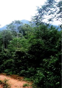
Gunung Yong Yap as seen from the way to the campsite(June 2006) |
| Location | Perak, Malaysia |
|---|---|
| Height | 2618 m |
| Terrain | Mixed forest trail, river crossings. |
| Recommended duration | 3 days, 2 night |
| Ease of access | 4-wheel drive to starting point of trek |
| Special equipment | None |
| Good | Relatively short for a Titiwangsa trek. Unspoilt trek. |
| Not so good | Sandflies |
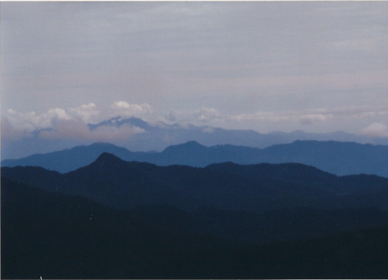
View of the surrounding mountain ranges can be seen from the summit of Gunung Yong Yap (June 2006) |
This is a trek that brings you into the wild jungles of tropical Malaysia where the presence of wild animals like elephants can be felt. Gunung Yong Yap is the 6th highest mountain in Peninsula Malaysia and like many others above 2000 m, it is situated along the Titiwangsa Range. Although technically in Perak, it sits on the border of Perak and Kelantan. Reaching the summit of Gunnug Yong Yap, you will be rewarded with a view of several other peaks such as Gunung Yong Belar, Gunung Gayong, Gunung Korbu. This mountainous range is still home to wild Asian elephants, tigers and many other large animals and although they are seldom seen, you will know that they are around from evidence of elephant dungs and pondoks (huts) that have been brought down by the elephants. There are two routes for the trek to the summit each with its own charateristic.
The original route is to start at an Orang Asli village at Kuala Mu and it takes three days to cover the trek. The ride from the small town of Lasah to Kuala Mu requires the use of a 4-wheel drive (4WD). Most part of the two hour drive is on dirt road where logging activity can still be seen nearer to the main, tarred road. Away from the main road, the condition of the road deteriorates. Muddy depressions and potholes on the ground made the ride bumpy. Orang Asli villages can be seen scattered along the logging trails and at certain parts, small scale oil palm plantations can be seen. The dirt road ends at an Orang Asli village right beside Kuala Mu.
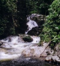
Kubuk Buaya waterfall which is located near Kuala Mu (June 2006) |
The trail starts at the end of the village and it leads to Kuala Mu river which you will have to cross to continue the journey. The river rises to about waist deep and if you are lucky, the villagers may have erected a temporary bridge across the river by lashing bamboos together. The ascent to the campsite is gradual and the trail is a mixture of old logging dirt road and small forest trails. The guide may point out tiger droppings or the unmistakable elephant dung on the trail. If you are observant, you may be able to spot the footprints of elephants and other wild animals that have recently passed through the area. Where a pondok used to mark the campsite, elephants had brought it down and a new campsite has been set up in the forest near a stream between pondok one and pondok two. Sandflies are common at the campsite. It is said that in forests where larger wild mammals live, sandflies are common and a sudden presence of large number of sandflies is a sign that a large mammal is nearby. Horsefly which looks like giant housefly and up to an inch long may sometimes visit the campsite. The female horsefly requires a blood meal for reproduction and its bite is painful. You can feel it immediately.
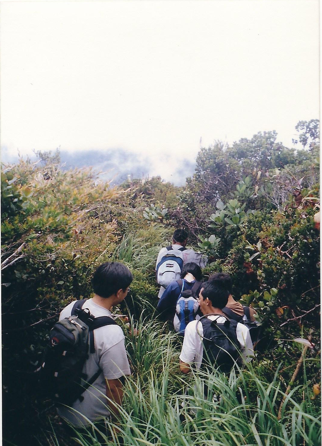
Terrain along the summit ridge (June 2006) |
The next day is the summit day. Leaving the tent and other items behind, a smaller back-pack is used to carry sufficient water, lunch and raingear for the trip to the summit and back. It is generally uncommon to find more than one group on this trek thus there is very little risk of theft by other people. Higher up the mountain, you will be trekking through the mossy forest with the ground and trees covered with moss. Unlike some other peaks on Titiwangsa range, you will be rewarded with a view of the other mountains on this summit. Another night will be spent at the campsite before going back to Kuala Mu. Some bloggers and websites have mentioned that it is now possible to take the 4WD right to the first pondok [1, 2]. The trek starts here and you will be able to camp nearer to the summit if you are early or take a short trek to the campsite for the night.
The second route up Gunung Yong Yap is via Pos Brooke about 25 km from Kampung Raja of Cameron Highlands. This route is said to be easier probably because it starts from a higher altitude. However, the downside is that it requires multiple river crossings and may significantly slow down the team if it is large. It takes three days to complete the trek via this route [3, 4].
Gunung Yong Yap is probably one of the easier treks of the G7 mountain of Peninsula Malaysia. The route via Kuala Mu is now easier with 4WD going to the first pondok on that route. The trek duration is relatively short and the campsite is near a water source. Having a view at the summit of the mountain is also a big plus. However, Gunung Yong Yap is not recommended for first timers as it is tougher than other more commonly visited lower peaks in Malaysia. If you wish to embark on a more adventurous trek, this will be a good introduction to the peaks on Titiwangsa range.

- My Mountain Adventures, August 2008
- Travelling around Malaysia or Trekking the Mountains of Malaysia, 03 May 2007.

To Nearest Town
Take a bus to Medan Gopeng bus terminal. You may check out the available bus services, prices and dates on http://www.busonlineticket.com
Take a bus from Medan Gopeng to Lasah.
Duration: 1 h 15 min
To Kuala Mu
4WD ride from Lasah to Kuala Mu, Orang Asli village.
Duration: 2h

| Duration (mins) | Description | Remarks |
|---|---|---|
| 00 | Kuala Mu, Orang Asli Village | |
| 10 | Bridge, river crossing | |
| 3 h 30 min | Pondok 1 | Collapsed |
| 40 | Stream, campsite | Campsite is across the stream |
| 10 | Pondok 2 | Collapsed |
| 2 h | Mossy forest | |
| 35 | Anak Yong Yap | |
| 15 | Last water point | Water source is 5 mins away from the main trail. Start of muddy ascent |
| 1 h 30 min | Summit of Gunung Yong Yap |
June 2006. Courtesy of The Mountain Trekker[5]
Summary Timings
| Starting point to campsite | : approx. 4 hours 20 minutes |
| Campsite to summit | : approx. 3 hours |

Travel to Kuala Mu
Start trek after lunch
Setup camp
Day 2:
Trek to summit and return to campsite for another night
Day 3:
Trek to Kuala Mu and return to town

Permit can be applied from the Forestry Department with the assistance of the guide
Mr Goh (aka Taiping Goh - organiser/lobang king): +60126247446 (hp)
cs_goh@yahoo.com (email)
Syafiq (4wd or guide): 0125330297 (hp)
Syafiq_5129@yahoo.com (email)
Ham (silver outdoor guide): 0125729493 (hp)
Edham_adteckulim@yahoo.com (email)

- Outdoors Sandals
- Light weight clothes
- Tent
- Groundsheet
- Gas stove and canister
- Lamp/torch
- Pots for cooking/ Mess Tin
- Small Shovel
- Nylon string
- Water Purification Tablets
- First Aid Kit
- Toiletries
- Toilet Paper
- Extra clothing
- Kitchen utensils (Fork, Spoon)
- Rain gear
- Sleeping bag
- Cap/Hat
- Windbreaker/Jacket
- Lighter
- Swiss Knife
- Insect repellent
- Water container

- Mountain Forays Malaysia. http://www.angelfire.com/trek/mofam/Mountain%20Info/gunung_yongyap.htm [15 May 2015]
- Travelling around Malaysia or Trekking the Mountains of Malaysia. http://malaysiatrekking.blogspot.sg/2007/05/gunung-yong-yap-perak-g7-mountain.html [15 May 2015]
- 12 highest mountain in Malaysia. http://ooiguanyi.blogspot.sg/2014/02/Malaysia-Highest-Mountain-Gunung-Hiking.html [15 May 2015]
- AllTrails. G7 - Mount Yong Yap (2167m above sea level). http://alltrails.com/events/2014/09/g7-mount-yong-yap-2167m-above-sea-level [15 May 2015]
- TheMttrekker, Gunung Yong Yap https://themttrekker.wordpress.com/gunung-yong-yap/ [15 May 2015]